City Digital Twins for Better Urbanization in Developing Countries
I’m happy to announce that our lab received an award from NVIDIA, which supports our project on city digital twins and urbanization in developing countries.
More than 20 percent of the world's population lacks safe housing. With more frequent and deadly natural disasters, the housing sector continues to suffer significant damage and risk. However, many influenced countries are developing countries and they don’t have efficient tools to help understand their environment and make informed decisions when it comes to rapid urbanization under changes.
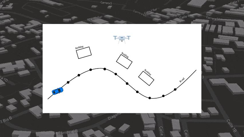
This project develops a system for creating digital twins of existing buildings using images collected from the streets, and develops algorithms for analyzing buildings and households with digital twins. At the city scale, street view images are collected using a camera mounted on a vehicle. These images are fed into the tool we developed, where we use an AI-empowered pipeline to extract information and create a digital twin of the city. Combined with multiple sources of data, we then developed machine learning-based models to estimate the risk of building structures and the fragility of households, which informs finance and insurance policymaking.
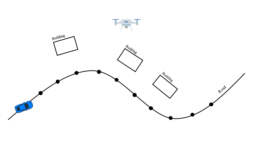
Figure 1. City Digital Twin Creation
In an application of our tool, we scanned a whole city in Mexico (Figure 2) and found buildings that are most vulnerable to earthquakes. Retrofit of these buildings can cut losses by half in future earthquakes. It can take a year for a professional team to perform the task for a city. With our in-house software and NVIDIA GPUs, this can be done within several hours. For a typically populated city to be analyzed, more than 1,000,000 images need to be processed to build a digital twin with satiatifying resolution.
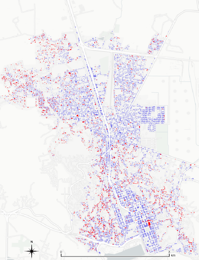
Figure 2. Seismic vulnerable buildings found in Salina Cruz, Mexico.
In another example (Figure 3), our model was able to infer the fragility of households and communities by scanning the street view images, which helps decision-makers find and validate families that need help most urgently.
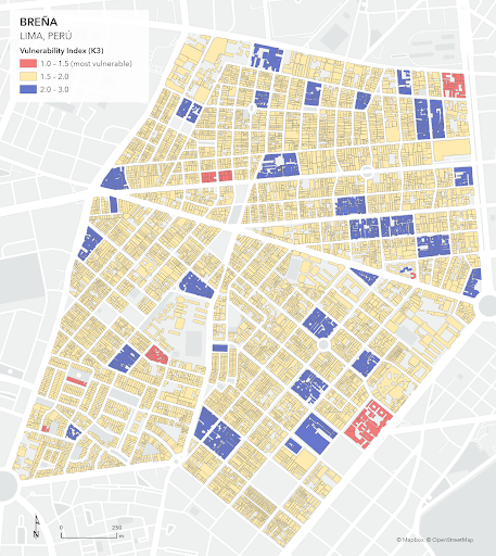
Figure 3. Vulnerability households in Breña, Peru
Aligning with the above examples, understanding the built and natural environment is a critical research agenda in various fields: engineering, planning, social science, economy, etc. In these fields, usually, the first step is to collect various information (buildings, road networks, commercial entities, population, etc.). Our broader goals are to: create a realistic digital twin of the built environment to assist simulation and analysis, which helps understand the built and natural environment to lead to better urbanization.
This project recently received a seed fund from NVIDIA Applied Research Accelerator Program to further develop the algorithm and framework and make the technique accessible to developing countries to assist their urbanization, in collaboration with the World Bank, who will help data collection. The core of our system is large-scale image analysis, 3D reconstruction, and data-centric algorithms. NVIDIA GPUs will provide the computational power.
Special thanks go to NVIDIA AI Technology Center (NVAITC), NVIDIA Applied Research Accelerator Program, and World Bank
···
